SEARCH



A strip of rock between Europe and Africa is a laboratory for extreme logistics, autonomous technologies and new models for managing sensitive territories.
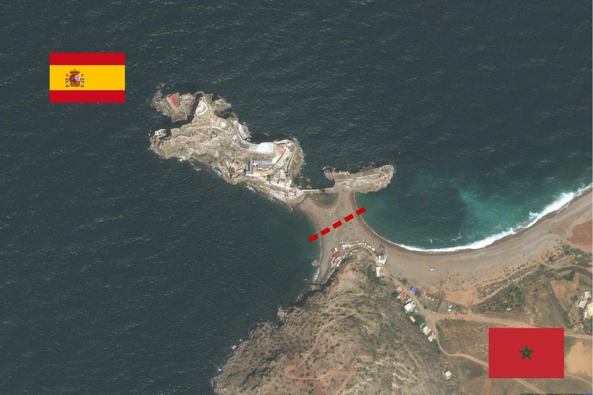
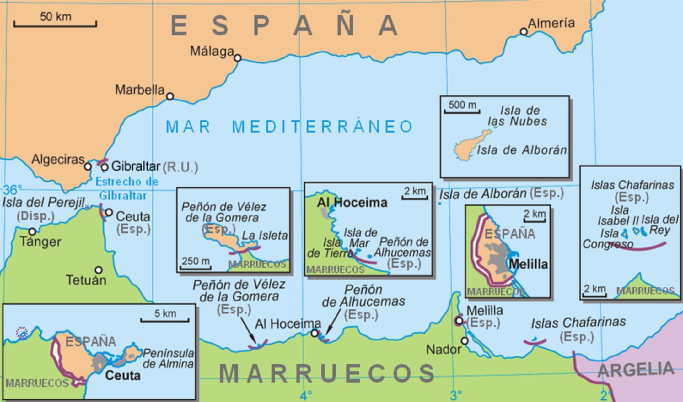
Il Peñón de Vélez de la Gomera It is one of the smallest and least-known territories under European sovereignty outside the continent. A mere few meters of land border, a permanent military presence, harsh environmental conditions, and a total absence of a permanent civilian population. It might seem like a historical remnant with no current relevance. In reality, precisely because of its extreme nature, this micro-enclave represents an interesting case study to observe how logistics innovation, energy self-sufficiency e remote monitoring technologies are transforming the management of border territories.
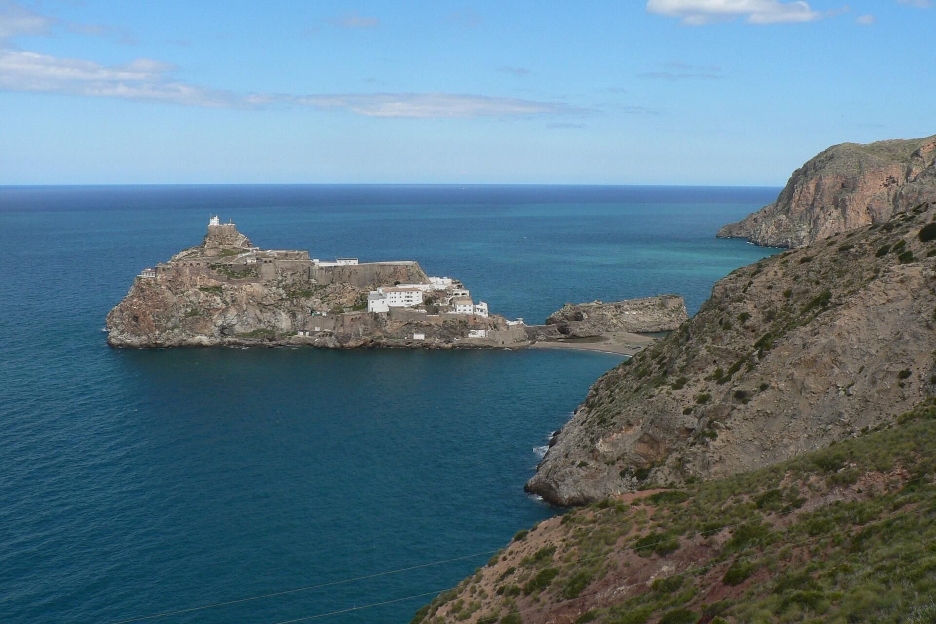
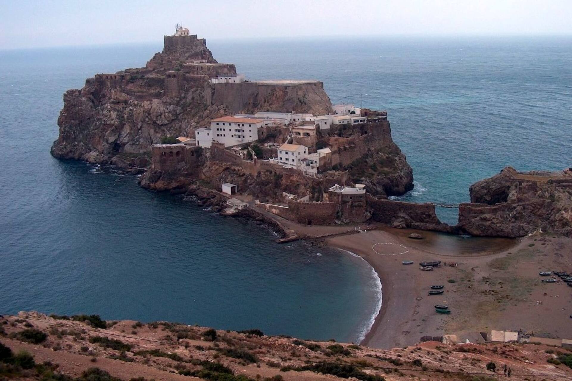
Originally, Peñón was a rocky islet located a short distance from the Moroccan coast, flanked by a smaller rock now connected by a small bridge. In 1930, a seismic movement caused an accumulation of sand that joined the rock to the mainland, transforming the island into a peninsula. Thus a sandy isthmus just 85 meters long: probably the shortest land border in the world between Kingdom of Spain and Kingdom of MoroccoEven today, a simple line marked by a blue cable marks the border, guarded by Moroccan forces on the mainland side and by the Spanish garrison on the promontory.
In the current context, marked by migratory pressure, maritime surveillance and geopolitical competition in the wider Mediterranean, even the so-called Spanish “plazas de soberanía”. They have entered a phase of operational upgrades. Not for expansion, but for efficiency. The key is infrastructural resilience.
A long history of conquest, sieges and strategic continuity
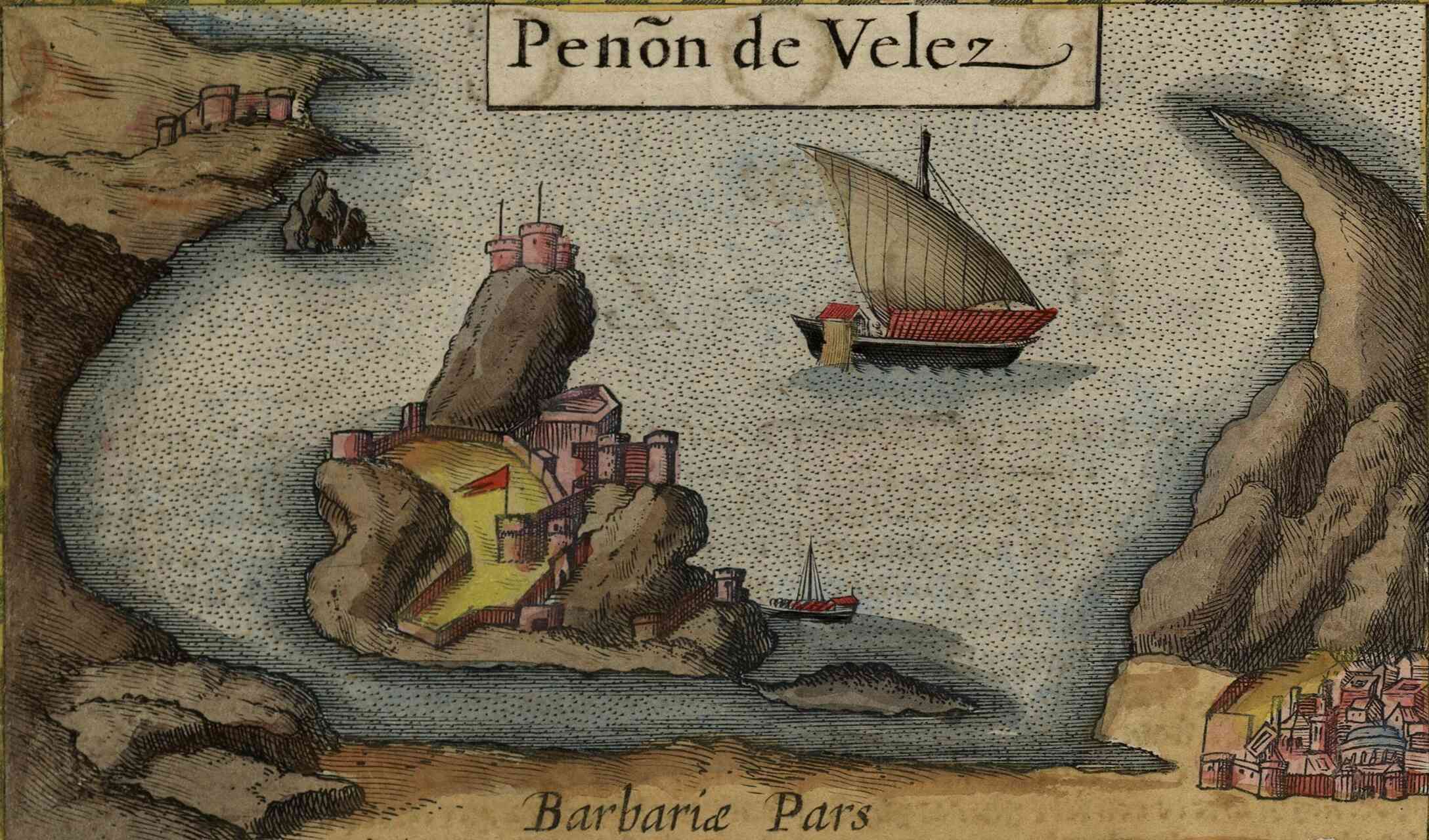
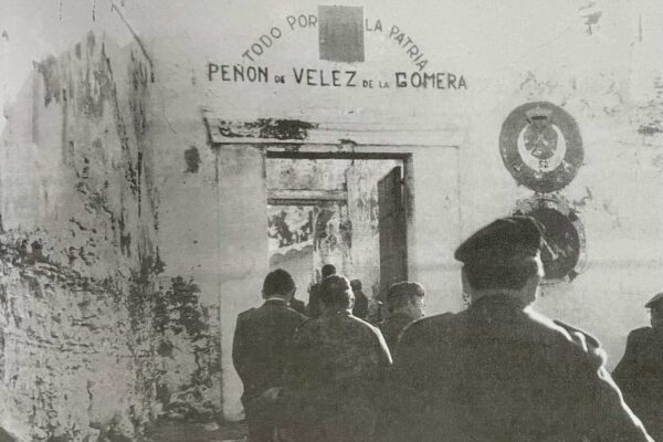
Today's technological dimension is grafted onto a dense historical stratification. In 1508 the peñón, then a refuge for pirates, was conquered by Pedro Navarro, soldier and sailor active in the Italian campaigns in the service of the Great captainThe lack of fresh water forced him to also occupy the coastal strip opposite. The first phase of domination was however short: in 1522 an enemy fleet, mistaken for reinforcements from the Iberian peninsula, managed to take the fortress, massacring the garrison.
After several failed attempts, in 1564 García Álvarez de Toledo Osorio reconquered the promontory, definitively consolidating the Spanish presenceSince then, Peñón has remained under the Iberian flag, experiencing wars, colonial crises and regional tensions. In 1922, during the clashes with Morocco in the context of the Rif war, suffered a heavy siege, then repelled thanks to the intervention of the Legion's forces.
Even in recent times there has been no shortage of symbolic episodes. August 29, 2012 seven young people belonging to the so-called Coordination Committee for the Liberation of Ceuta and Melilla they managed to enter the peñón by hoisting a Moroccan flagThey were immediately stopped by the garrison and repatriated. A brief episode, but indicative of the site's enduring geopolitical sensitivity.
Minimum frontiers, maximum operational management complexity
With a surface area less than 20 thousand square meters and an entirely rocky morphology, the Peñón imposes radical technical constraintsThere are no natural water resources, storage capacity is limited, and access depends on weather and sea conditions. In the past, this meant continuous supplies by ship, including water transport by aljibes.
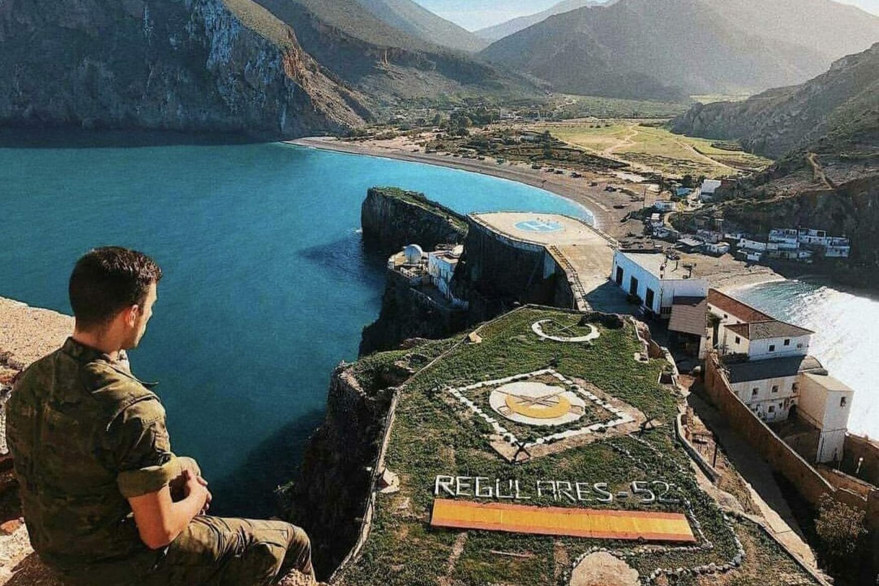
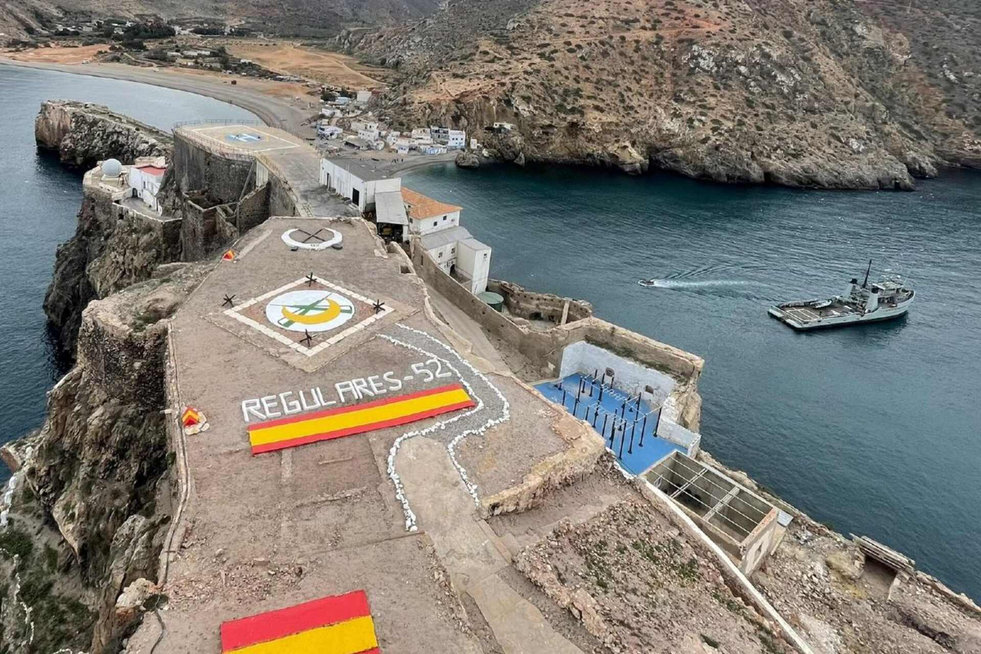
Today the garrison, a reduced contingent of Regulars Group Number 52, can count on a small desalination unit and on systems of inventory rationalizationThe supply remains entrusted to units of the Armada and helicopters of the Ejército de Tierra, but the logic has changed: less repetitive transport, More local production e intelligent consumption management.
In recent years, European armed forces have invested in security solutions autonomous logistics for isolated sites: hybrid generators, high density batteries, sensors for the predictive maintenance, low-impact prefabricated modules. Technologies developed for advanced bases or international missions are gradually being adapted to small-scale permanent facilities.
At the same time, digital land management has evolved. High-resolution maps and continuous geospatial surveys allow for a morphological monitoring constant feature of the sandy isthmus, subject to erosion and instability. A seemingly minor detail, but crucial in a context where a few meters define an international border.
Next-generation surveillance, sensors, and remote control
Ultra-small border territories are ideal environments for the adoption of integrated surveillance systemsCompact coastal radars, multispectral cameras, motion sensors, and automated observation platforms reduce the need for a large on-site presence. The operational model is shifting from intensive to technologically augmented garrison.
Border security today relies not only on physical presence, but also on the integration of sensors, data, and real-time analysis capabilities. Digital systems enhance the effectiveness of operations even in the smallest and most isolated areas.
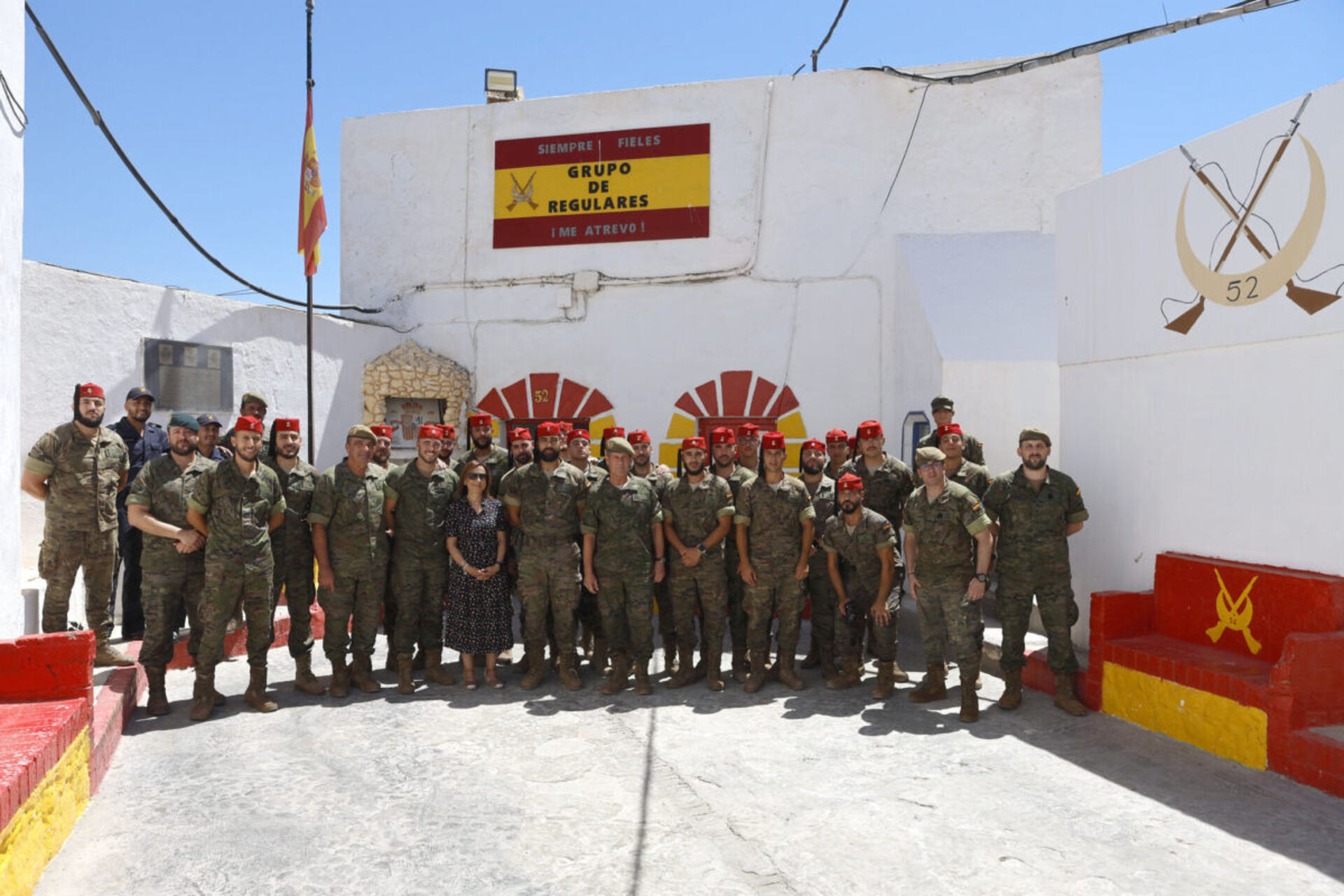
said Margarita Robles Fernandez, Spanish Minister of Defense, who in 2024 visited both the Peñón de Vélez de la Gomera and the Peñón de Alhucemas to thank the garrisons for their service and reiterate the strategic value of these territories.
“The digitalisation of maritime surveillance is now a structural factor of European security, especially at the points of contact between Africa and Europe”,
stressed Felix Arteaga, senior researcher on security and defense at the Real Instituto Elcano in Madrid.
This interpretation is consistent with the evolution of smaller communities: less mass, more technology. Micro-territories become network nodes. They matter not in terms of size, but rather in terms of location and capacity to generate information.
Energy self-sufficiency and resilient micro-infrastructures
Another area of innovation concerns energy. Isolated sites like Peñón are natural candidates for hybrid microgrids: combinations of photovoltaics, backup generators, and storage systems. Reducing battery costs and improving control electronics have made previously expensive configurations viable.
Water follows the same logic. Modern compact desalination plants, integrated with quality monitoring and energy recovery systems, are an essential part of the operational resilienceIn a place where for centuries the lack of water sources has led to defeat and vulnerability, technology radically changes the paradigm.
Today's infrastructure (helipad, renovated accommodations, telemedicine services, and even a small basketball court) is a muted reflection of the historic bastions, but it demonstrates a functional adaptation to contemporary needs: shorter stays, guaranteed minimum well-being, and remote healthcare support.
Memory, local cemetery and human heritage management
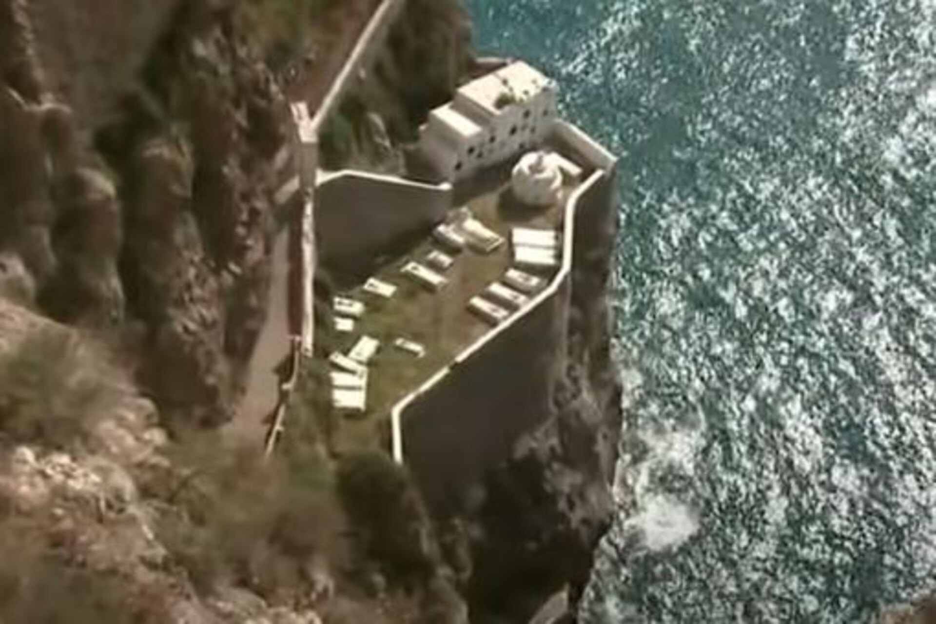
For a long time, civilians also lived alongside the military. A procession with the image of San Sebastián, the peñón's patron saint, after a devastating plague epidemic, bears witness to a now-extinct community. On the rocky slopes, there was a small cemetery with niches and pantheons that housed fallen soldiers and residents who died on the site.
Among them, the military pharmacist Leopoldo Méndez Pascual, who died in 1909 while defending his post at the hospital pharmacy. A mausoleum was erected in his honor by his colleagues in the Military Medical Corps.
In 2021, the Spanish Ministry of Defense ordered the transfer of buried remains in the peñones of Vélez de la Gomera and Alhucemas at the cemetery of theImmaculate Conception of Melilla, justifying the decision with the structural deterioration of the cemetery and the difficulties of its conservation. The measure sparked debate in some circles, concerned about its symbolic implications, but it marked a new phase in the centralized management of the historical-military heritage.
From a strategic rock in Africa to a smart network node
Il Peñón de Vélez de la Gomera It was born as a maritime fortress and a symbol of imperial expansion. Today it can be read as an example of silent transformation: from a static garrison to intelligent control nodeIts extreme size highlights a broader trend: innovation is not just about smart cities, but also micro-spaces of high geopolitical criticality.
Compact technologies, energy autonomy, distributed sensors and data management are redefining the concept of territorial presence. It's no longer just a matter of walls and cannons, but of integrated systems, interoperability, and real-time analysis capabilities.
For public policymakers and the innovation industry, these micro-territories represent high-value testing environments: small perimeters, concrete problems, scalable solutions. The frontier, even when it measures just 85 meters, thus becomes an advanced testing ground for innovation. technological transformation of security.
The Peñón de Vélez de la Gomera in a documentary by the Spanish Ministry of Defense
Here are three insights that might interest you:
Odissea inaugurates its tourism startup incubator in Ceuta.
Canary Islands, a laboratory for technological and sustainable innovation
“Second Life”: Stronger Networks with Recycled Batteries in Melilla