SEARCH




SmartICE integrates data and sensors with Inuit knowledge, offering communities shared tools to decide how to navigate a changing climate.
There are activities that, when described, don't even seem real. Like monitoring and mapping ice to help people decide when and where to travel on the frozen surfaces of the North. A practice that, inevitably, would have to do with the unpredictability of climate change and, at the same time, with the intention of indigenous communities to continue moving, working, and maintaining cultural practices deeply rooted in the land. Yet all this really exists and has a specific name: SmartICE.
The climate change adaptation organization, led by indigenous peoples of the North and created for bringing local knowledge of the ice into dialogue with innovative satellite monitoring and mapping tools, translates its services into concrete data on ice thickness and travel conditions (nearly) in real time. This business model is also designed to expand economic and social development opportunities in the communities involved, with the goal of maximizing social impact and generating positive change through information services built collaboratively, with and for communities.
The very birth of SmartICE is intrinsically linked to a concrete local experience. The project was in fact co-created with the Government of Nunatsiavut in response to extremely dangerous ice conditions Tested by residents of Nain in the winter of 2010, a community research partnership then developed practical technologies and information tools for travelers. Only after being awarded the Arctic Inspiration Prize in 2017 did the initiative evolve into the social enterprise it is today, aiming to offer an operational service developed by Inuit for coastal communities throughout the Arctic.
An organization with and for Northern communities
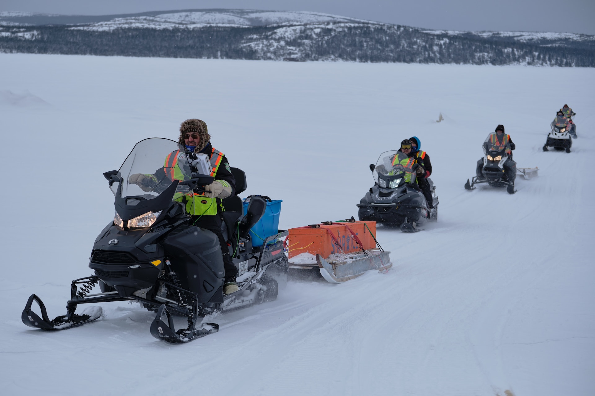
Since 2017 SmartICE Inuit has collaborated with 37 communities throughout Inuit Nunangat, the Northern Territories, and northern British Columbia. Today, the organization—with northern operations centers in Nain, Nunatsiavut, and Pond Inlet, Nunavut—has over 35 employees, with 40 percent of the staff identifying as Indigenous. During the ice season, however, the number of people involved grows to over one hundred units.
The impact of the project is reflected on multiple levels and is closely linked to the founding principles of SmartICE, including the centrality of indigenous leadership in every aspect of operations and decision-making processes. By offering communities the opportunity to exercise self-determination in climate adaptation activities, the organization also contributes to indigenous reconciliation. Governance is entrusted to a council composed of people from coast to coast, each with diverse skills and perspectives. This focus on diversity is also reflected in the organization's internal structure, which has made inclusive representation a commitment across all levels, adhering to the Canadian 50-30 Challenge promoted by Innovation, Science and Economic Development Canada.
In summary, through a social enterprise approach to work integration, SmartICE provides tools, training and support needed to address changing ice conditionsSuffice it to say that in three years, over 100 Indigenous people have been trained and employed as producers, operators, and technicians of the technologies developed. Furthermore, in the 2019-2020 ice season in Nunavut alone, SmartICE trained 46 operators, employed 33 young people, and generated over 5.600 hours of work.
The social component that accompanies the technological one
The daily work in the territory has found a point of reference in the Northern Production Centre Nain, where SmartICE has built relationships with community members and local governments over time, also supporting participatory events. This has led to the development of best practices for youth training and the installation of monitoring tools in Nunatsiavut communities, strengthening a presence that clearly combines the technological and social dimensions.
An approach that has received recognition over the years growing recognition, both nationally and internationally. From early awards related to innovation and social impact, such as the Arctic Inspiration Prize in 2016 and the United Nations Momentum for Change recognition in 2017, to more recent accolades for work, leadership, and inclusion. These include the Governor General Innovations Award, several awards for community engagement, and, more recently, recognition for diversity, workplace safety, and the ability to create quality work environments, culminating in its inclusion among the Best Places to Work in 2026.
Winter ice from essential resource to risk factor
First, why is ice so important to Northern communities? The answer is essential: because it is a vital part of the indigenous way of lifePeople living in northern communities rely on ice for everything: to hunt and gather food for their families, to gather firewood to heat their homes, to travel and visit relatives and friends in neighboring communities, and to engage in cultural activities.
And if climate change is transforming these environments around the world, nowhere is it happening more rapidly than in the North CanadaRising air temperatures are indeed leading to shorter ice seasons and increased slush. Meanwhile, the ice itself is thinning at an alarming rate and is increasingly unpredictable, leaving many communities with growing fears about travel risks. The danger, unfortunately, also extends to the culture, identity, and livelihood of Inuit throughout the north.
Climate change and the resistance of the populations of the North
By combining indigenous knowledge with the advanced monitoring technologies developed by SmartICE, communities can take more informed decisions before traveling on the ice. This process also includes the production of local maps, created by SmartICE staff in consultation with community members, to document the most dangerous areas. The organization then makes these materials available in both digital and paper formats, as practical tools to support travel on the ice.
On this basis it is grafted Sikumik Qaujimajjuti, a training program developed over the past five years at the request of the Community Management Committees (the local decision-making bodies with which SmartICE collaborates in each operating community). The initiative stems from the desire to engage young Inuit in activities that combine traditional knowledge and contemporary tools.
The objectives therefore include documenting and sharing Inuit Qaujimajatuqangit (IQ) related to safe travel on the ice, learning techniques for interpreting satellite imagery, and monitoring ice conditions outside of inhabited areas. This is complemented by the creation of specific products for ice travel safety, developed based on the needs of each community.
SmartICE sensors and their operational differences in detail
SmartICE’s remote environmental monitoring systems, as mentioned, provide communities with valuable, evidence-based data on sea ice thickness, in near real time. But let's clarify..
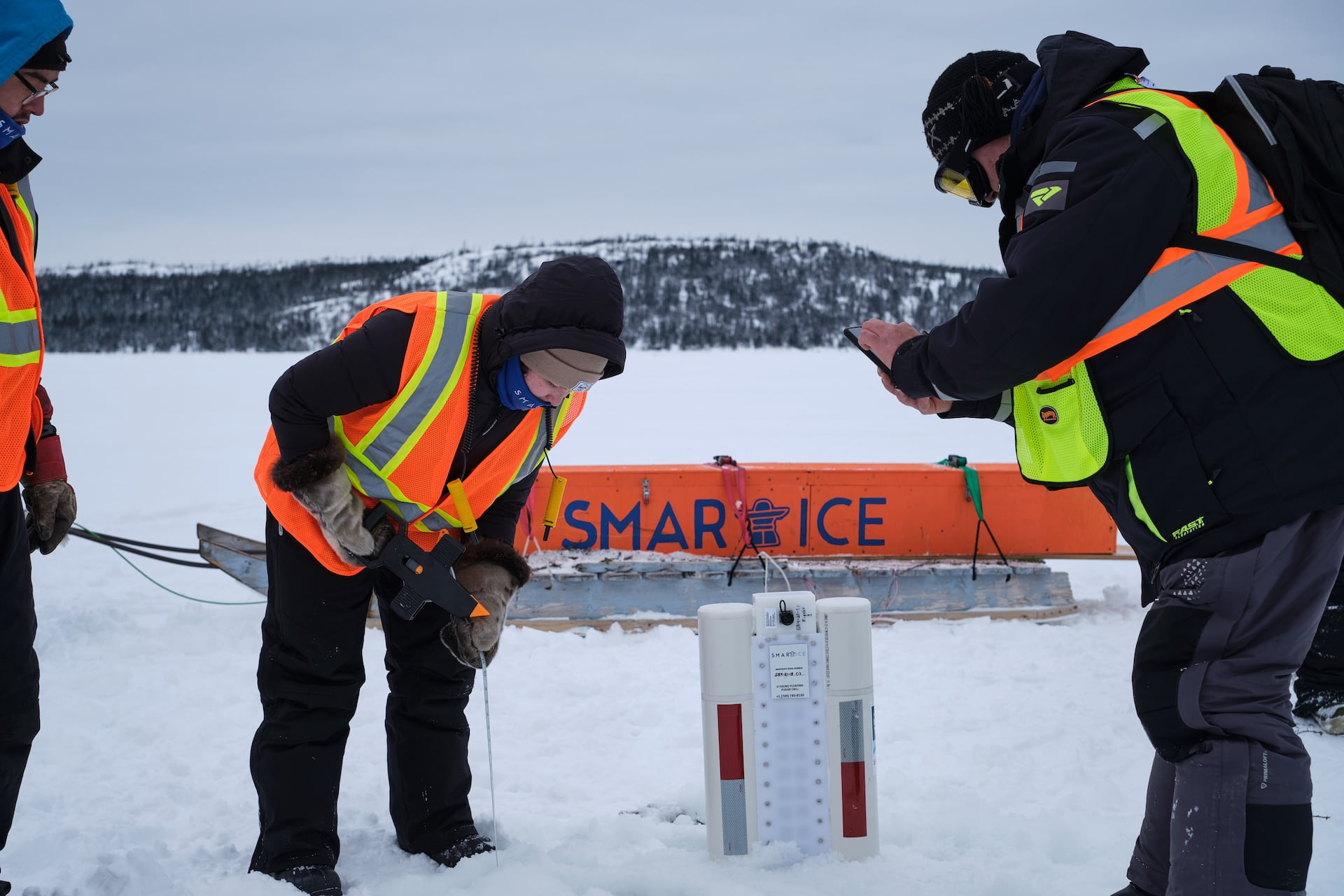
- SmartBUOY They are stationary sensors, approximately 2,5 meters long, inserted directly into the ice to measure its thickness through an array of thermistors, similar to thermometers. Each SmartBUOY is equipped with 60 thermistors that detect the temperature of the air, snow, and water. From these measurements, a thermal profile of the different layers is constructed, allowing for precise determination of the ice thickness. The collected data is transmitted to satellites once or twice a day and made available to communities on SIKU.org, a platform and app dedicated to sharing Inuit knowledge, allowing you to consult data before you travel and integrate this information with firsthand observations, photographs, and traditional Inuit knowledge of ice conditions.
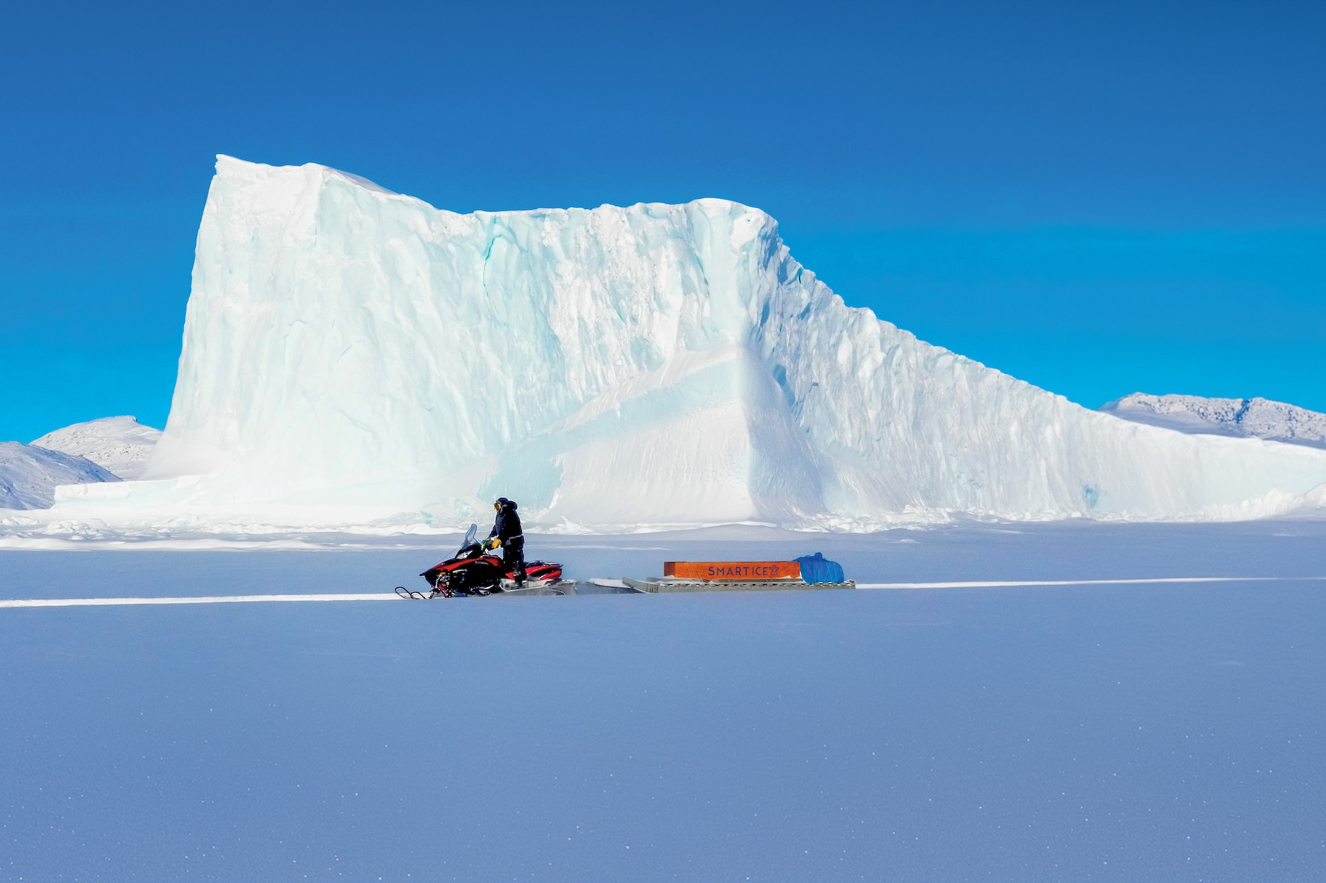
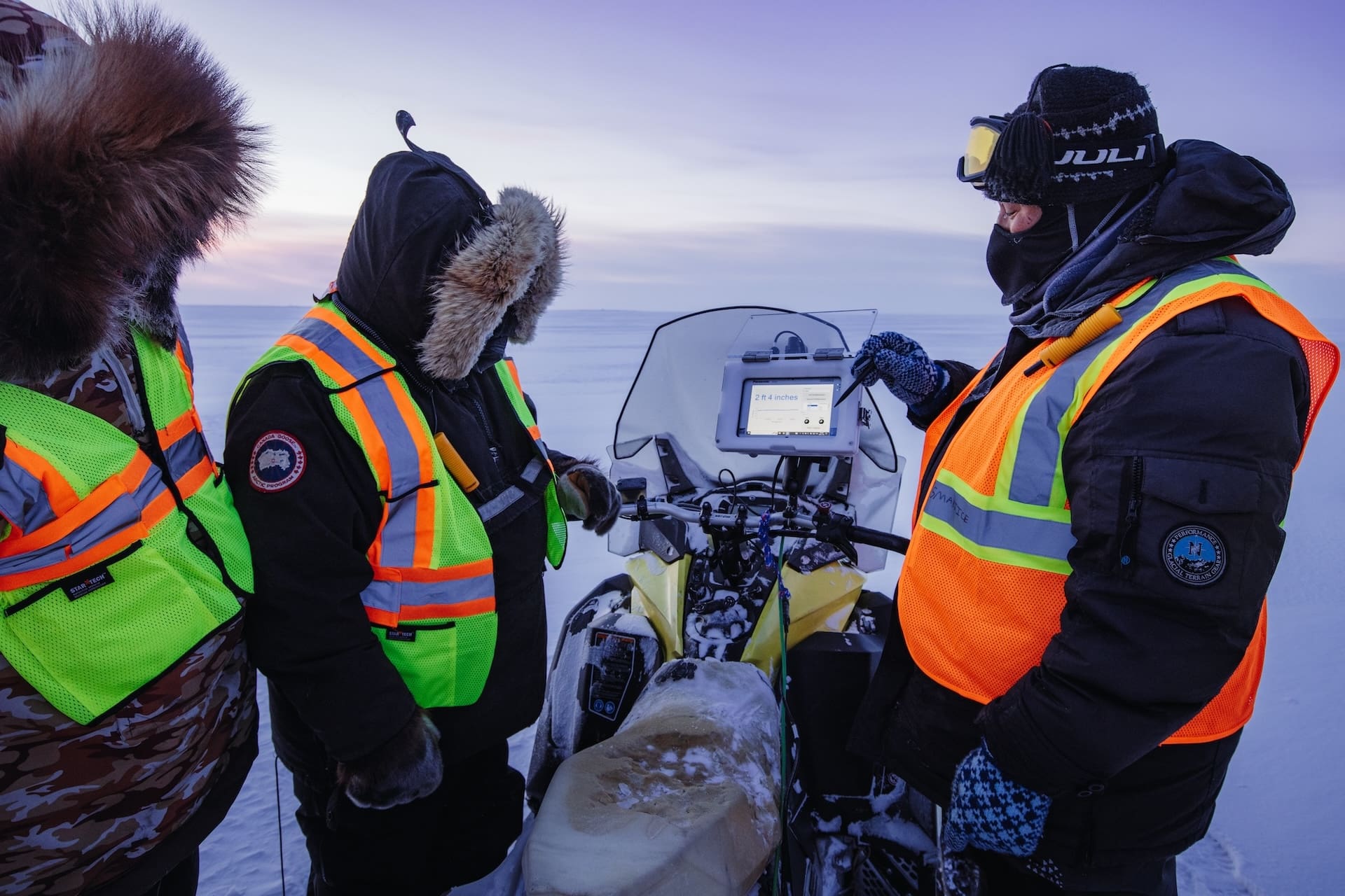
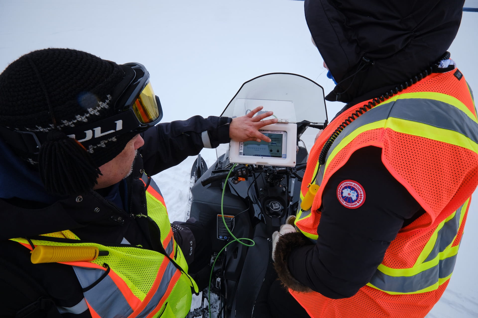
The system SmartQAMUTIK, SmartKAMUTIK In the dialect of the Nunatsiavut region, it is a sensor mounted and towed by a snowmobile, capable of providing real-time measurements of snow and ice thickness directly to the operator. This instrument provides crucial information on ice conditions along the trails used by communities. The measurements in this case are based on the salinity of seawater: the system transmits electromagnetic signals through the snow and ice, which induce electrical currents in the saltwater below and return to the sensor, producing an instantaneous estimate of the overall thickness, from the snow surface to the base of the ice. These measurements are taken at least once a week, with the data then made available to the community through the aforementioned platform, as well as through digital and social media, local radio, and printed materials.
The important solution under development for fresh water
Once we've explained how the SmartQAMUTIK system works, it's natural to ask whether SmartICE technology also works in freshwater. The answer is no. Or rather, not yet: Currently, the systems are only operational in saltwater, with technologies for use in freshwater being developed at the YYT Tech Shop in St. John's, Newfoundland.
The integration, and never replacement, of indigenous knowledge
It is important to underline that one of the founding principles of SmartICE is integration, and not the replacement, indigenous knowledge related to safe travel on ice. Traditional knowledge of communities forms the true foundation of safety on the pack ice, while data provided by technology represents "only" an additional tool to support them.
And precisely because SmartICE actively supports the needs of the place (and the populations) in which it operates, the aforementioned initiatives are established in each community served by the program. Community Management Committees, composed of elders, youth, and representatives of local organizations. The committee determines how the organization should operate in the area, where to implement technologies, and makes recommendations on further ways the program can support safe travel on the ice.
During the ice season, members of local communities are also hired and trained as SmartICE technology operators, through a comprehensive and structured training program. At the same time, SmartICE involves and trains young indigenous people from Nain, Nunatsiavut, in the production of SmartBUOYs through theEmployment Readiness and Technology Development Program, hosted at the Northern Production Centre in Nain. Lasting five weeks, it combines technical training and basic socio-emotional skills development, designed for indigenous youth not in education or training, and offers them the opportunity to assemble the SmartBUOY technology.
Document, share, support, expand: future plans
Other projects SmartICE is working on include documenting seniors' knowledge of the seasonal ice cycle, with a focus on conditions considered safe for travel and those considered more dangerous. While federal agencies also collect, map, and share ice data, their use remains largely navigation-oriented. SmartICE is therefore intervening to fill this void, producing travel safety maps, created by staff from the same northern regions. Through workshops on ice terminology, community members share their knowledge, which is then disseminated in informational materials and safety brochures, distributed in Inuktitut and English, with the aim of preserving them and passing them on to future generations.
As for future plans, SmartICE intends to continue to promote the self-determination of indigenous communities in ice research and monitoring. The program is also planned to expand to the regions of Inuit Nunangat, Inuvialuit, and the Northwest Territories, with the potential to extend the model beyond the Canadian Arctic.
Here are three insights that might interest you:
Ice Sanctuaries in Antarctica for Climate Memory
Penguins and AI: The Smart Turn of Monitoring in Antarctica
An unprecedented PhD in Antarctica's eternal ice